3D Modeling & Data Analysis
Understand your property or project from an entirely new level
with interactive 3D models
with interactive 3D models

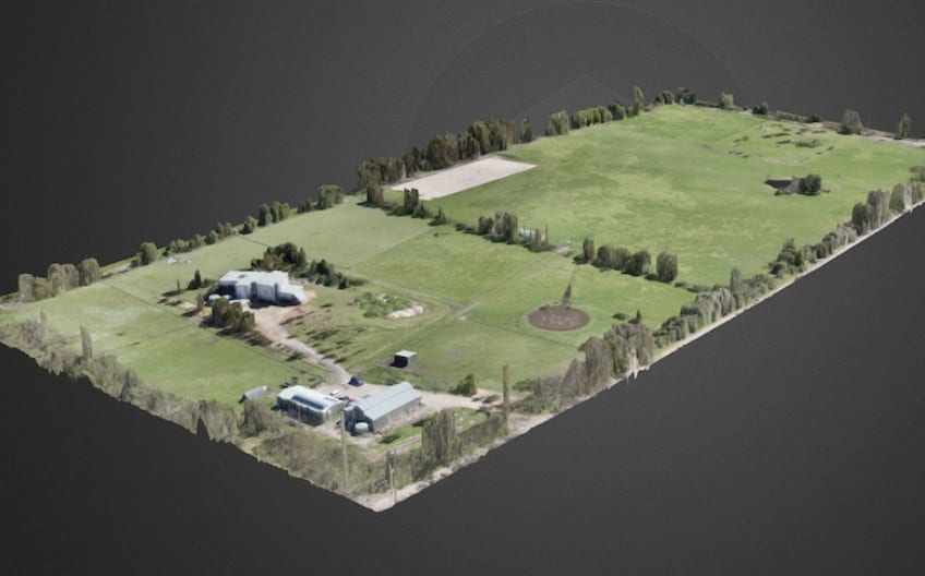
3D Models
Produce valuable 3D models of construction sites, commercial properties, or buildings. With advanced software, we combine data from multiple images to produce your 3D models. Visualize your property, measure volume, and calculate area.
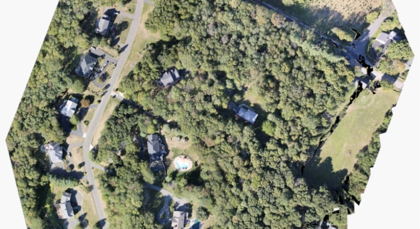
Orthomosaic Mapping
Capture huge, hundred-acre properties with precision, detail, and accuracy. We leverage advanced software to stitch together thousands of drone photos to produce high quality orthomosaic maps. See fine details with up to 0.7 in/px resolution.

Custom Requests
Get decision-enabling data from detailed arial images for whatever your project requires. We’ll work with you to make sure we capture the images you need to get the data your looking for.
3D Models
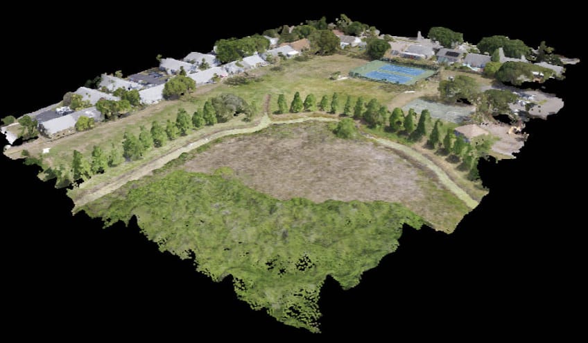
Create Building Models
We used advanced software and AI to intelligently combine hundreds of drone images, geo-referenced GPS coordinates, and altitude data into impressive 3D models.
Spin, rotate, and maneuver around your model with impressive detail and clarity. Gain deep insights into your project and visualize it from previously unseen angles.
With orthomosaic map resolutions up to 0.7 inches per pixel, you'll be able to see individual blades of grass poking through cracks in the parking lot. This level of detail & precision of such a large area is only possible with specialized mapping technology.
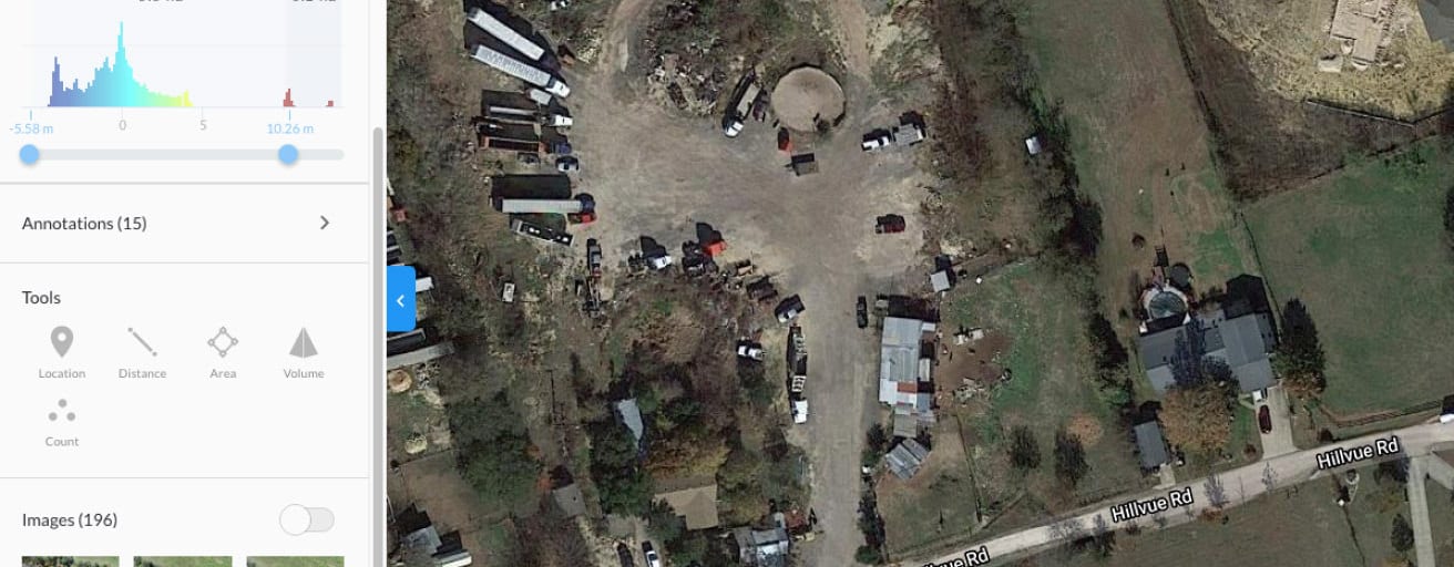
Powerful Data Analysis
Make advanced measurements and calculations on your model. Select points to measure the area of a rooftop, the distance between points, and even the volume of a stockpile.
Your model will display your points in 3D space and allow you to adjust them for precision and accuracy.
Your model will display your points in 3D space and allow you to adjust them for precision and accuracy.
Put Your Development Model in Context
Have a beautiful 3D rendering of your upcoming building and want to showcase it to potential clients, customers, or investors? Creating a 3D model of the surrounding area can be a great way to put your development in context.
Show how your future building will look, how the structure will integrate into the landscape, and other benefits your project has to offer.
Show how your future building will look, how the structure will integrate into the landscape, and other benefits your project has to offer.
Explore An Interactive Model
Below is a fully interactive 3D Model. Explore to see area calculations, distance measurements, and
understand how 3D mapping technology can work for you.
understand how 3D mapping technology can work for you.
Orthomosaic Mapping
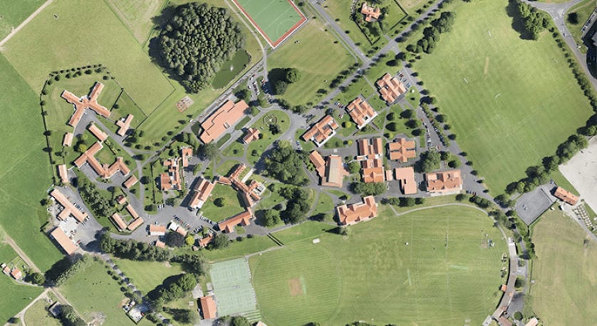
It's like Google Earth, but Way Sharper
Our orthomosaic mapping technology uses the drone's GPS location while its flying to stitches together thousands of high-resolution images and create a precise orthomosic map.
With map resolutions up to 0.7 inches per pixel, you'll be able to see individual blades of grass poking through cracks in the parking lot. This level of detail & precision of such a large area is only possible with specialized mapping technology.
With map resolutions up to 0.7 inches per pixel, you'll be able to see individual blades of grass poking through cracks in the parking lot. This level of detail & precision of such a large area is only possible with specialized mapping technology.
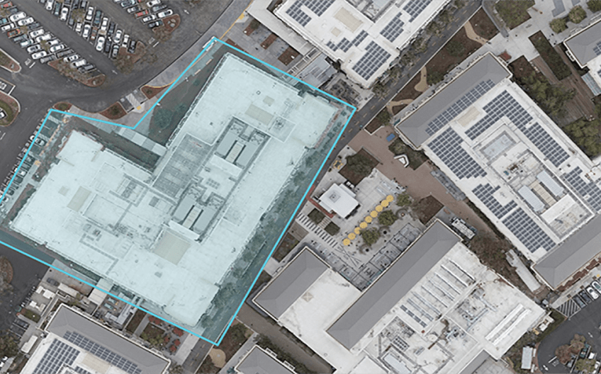
How Big? Calculate Area with Ease
The accuracy of our maps and imagery allow us to measure distances and calculate areas within your property. Know exactly how large a stockpile is, determine the square footage of a roof for repair or potential solar panel installation, or make other valuable calculations about your property.
How
Our Aerial Services Work
Our Aerial Services Work
- Simple.
- Convenient.
- Completely Custom.
We provide drone photography services nationwide and offer provide professional consistency and reliability for your brand. Our scale is large enough to enable fast turnaround times and eliminate any and all travel fees or expenses that could otherwise be borne by clients. The expert drone operators within our network are vetted and proven, and are ready to take on any project you send our way.
We offer flexibility to adapt our services for any project and provide a simple solution for getting quality results.
Contact us today and turn your project, product, or property into a compelling visual story in three easy steps.
Tell Us About Your Project
Get magazine-quality still photos of places, people, or events. Our photographers fly premium quality drones and will capture images of your subject from virtually any angle.
We'll Schedule a Flight
After confirming your project details & requirements, we’ll send a pilot to your specified location, wherever it is you need us.
Download Your Aerial Imagery
We will share your drone photos and videos with you and make them available to download within 24 hours following the time the shoot.