Orthomosaic Mapping Services
Get detail-rich aerial orthomosaic maps and actionable data
for your project.
for your project.

Orthomosaic Mapping
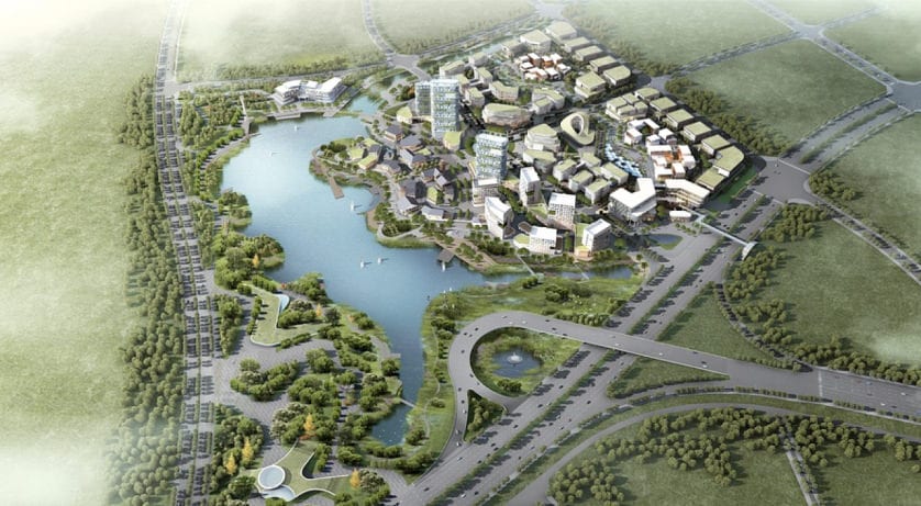
Capture huge, hundred-acre properties with precision, detail, and accuracy. We leverage advanced software to stitch together thousands of drone photos to produce high quality orthomosaic maps. See fine details with up to 0.7 in/px resolution.
What is an Orthomosaic?
It's like Google Earth, But Way Sharper
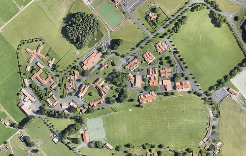
An orthomosaic map, or "ortho", is a single, geometrically corrected image created through the combination of many photos. Our orthomosaic mapping technology uses the drone's GPS location to capture geo-referenced imagery. Our software then merges, or stitches, together hundreds or thousands of high-resolution images to create a precise orthomosic map.
With map resolutions up to 0.7 inches per pixel, you'll be able to see individual blades of grass poking through cracks in the parking lot. This level of detail & precision of such a large area is only possible with specialized mapping technology.
With map resolutions up to 0.7 inches per pixel, you'll be able to see individual blades of grass poking through cracks in the parking lot. This level of detail & precision of such a large area is only possible with specialized mapping technology.
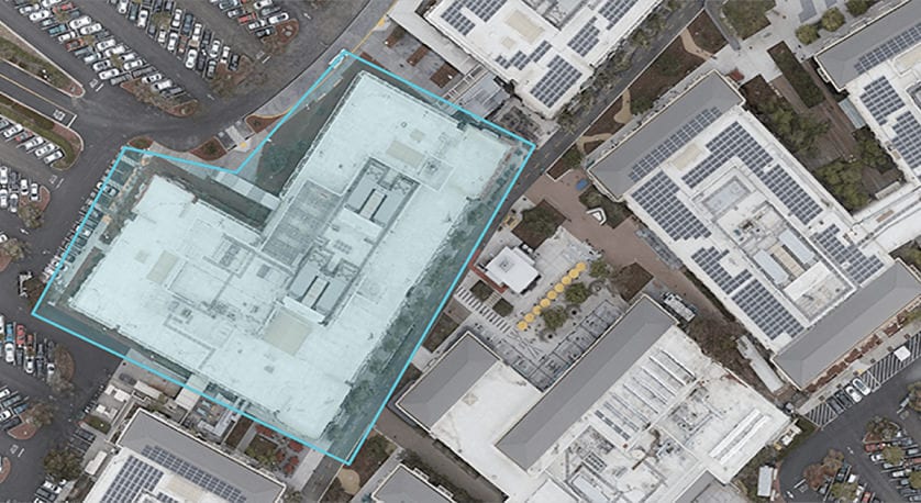
How Big? Calculate Area with Ease
The accuracy of our maps and imagery allow us to measure distances and calculate areas within your property. Know exactly how large a stockpile is, determine the square footage of a roof for repair or potential solar panel installation, or make other valuable calculations about your property.
Farming Just Got Easier
Combine orthomasic mapping with multispectral imaging technology to gain insights on plant health. New drones are capable of providing a Normalized Diffrence Vegetation Index for powerful crop analysys and for data-driven decisions. And all this is provided with centimeter-level precision.
How
Our Aerial Services Work
Our Aerial Services Work
- Simple.
- Convenient.
- Completely Custom.
We provide drone photography services nationwide and offer provide professional consistency and reliability for your brand. Our scale is large enough to enable fast turnaround times and eliminate any and all travel fees or expenses that could otherwise be borne by clients. The expert drone operators within our network are vetted and proven, and are ready to take on any project you send our way.
We offer flexibility to adapt our services for any project and provide a simple solution for getting quality results.
Contact us today and turn your project, product, or property into a compelling visual story in three easy steps.
Tell Us About Your Project
Get magazine-quality still photos of places, people, or events. Our photographers fly premium quality drones and will capture images of your subject from virtually any angle.
We'll Schedule a Flight
After confirming your project details & requirements, we’ll send a pilot to your specified location, wherever it is you need us.
Download Your Aerial Imagery
We will share your drone photos and videos with you and make them available to download within 24 hours following the time the shoot.